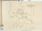
Map of the Leichhardt and Port Curtis districts.
Title
Map of the Leichhardt and Port Curtis districts.
Date made
1859Place made
Naam / Melbourne, Victoria, Australia View on map Close map
Reference
Ferguson (1941-69, 1986),
Category
Illustrated book
Print type
planographic
Technique
photo-lithograph, printed in black ink, from one stone
Text printed from matrix
Printed upper right wihtin image in black ink, 'BY W. LOCKHART MORTON 1859.' Printed lower right below image in black ink, 'REDUCED & PHOTO-LITHOGRAPHED FROM THE ORIGINAL DRAWING BY J.W. OSBORNE / AT THE CROWN LANDS OFFICE MELBOURNE 11th MARCH 1859.' Printed upper right within image in black ink, 'Map of the / LEICHHARDT & PORT CURTIS, / DISTRICTS.'
Edition information
print run unknown
Subject categories
Australia, Book arts: Illustrated book | Map
Legacy id
151987
Last Updated
20 Nov 2025
