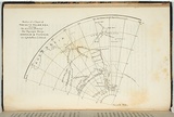
Section of a chart of the South Polar Sea.
Title
Section of a chart of the South Polar Sea.
Source
The Tasmanian Journal of natural science, agriculture, statistics Vol II. Launceston:Henry Dowling Jr, 1846.
Page or Plate number
facing p.41
Reference
Ferguson (1941-69, 1986),
Date made
1846Place made
Kanamaluka / Launceston, Tasmania, Australia View on map Close map
Category
Illustrated book
Print type
planographic
Technique
lithograph, printed in black ink, from one stone
Text printed from matrix
Printed upper left within image in black ink, 'Secrtion of a Chart of / SOUTH POLAR SEA. / shewing / The discoveries & Track of / Her Majesty's Ships / EREBUS & TERROR / in a high Southern latitude.' Not signed. No date.
Matrix size
11.6 x 14.8 cm (printed image (irregular))
Edition information
print run unknown
Subject category
Australia, Book arts: Illustrated book
Legacy id
151812
Last Updated
20 Nov 2025
Impressions
Collection
National Gallery of Australia
State
published state
Impression
undesignated impression as issued
view detailed information