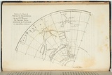
Section of a chart of the South Polar Sea.
Title
Section of a chart of the South Polar Sea.
Source
The Tasmanian Journal of natural science, agriculture, statistics Vol II. Launceston:Henry Dowling Jr, 1846.
Page or Plate number
facing p.41
Reference
Ferguson (1941-69, 1986),
Date made
1846
Place made
Kanamaluka / Launceston, Tasmania, Australia View on map Close map
Category
Illustrated book
Print type
planographic
Technique
lithograph, printed in black ink, from one stone
Matrix size
11.6 x 14.8 cm (printed image (irregular))
Support
thin off-white wove paper
Support size
13.2 x 21.0 cm (sheet)
State
published state
Impression
undesignated impression as issued
Edition information
print run unknown
Collection
National Gallery of Australia
IRN
151812
Accession method
Transfer
Subject category
Australia, Book arts: Illustrated book
Last Updated
11 Jan 2013