Chart of the north west coast of America and the north east coast of Asia explored in the years 1778 and 1779
Title
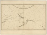
Chart of the north west coast of America and the north east coast of Asia explored in the years 1778 and 1779
Source
Cook, James and King, James. 'A voyage to the Pacific Ocean... for making discoveries in the Northern Hemisphere. London: Printed by W. & A. Strahan for G. Nicol & T. Codell, 1784
Page or Plate number
plate 36
Date made
1784Place made
London, Greater London, England View on map Close map
Category
Print type
intaglio
Technique
engraving, printed in black ink, from one plate
Text printed from matrix
Printed upper centre within image within plate-mark, 'CHART / of the / NW COAST of AMERICA and NE COAST of ASIA / explored in the Yeats / 1778 & 1779. / The unshaded parts of the Coast of ASIA are taken from an MS Chart received from the Russians'. Printed upper right above image within plate-mark, '36'. Printed lower right below image within plate-mark, 'Writing Engraved by T. Harmar.'
Edition information
print run unknown
Subject category
Voyages of exploration and discovery 1600-1900: English
Legacy id
213846
Last Updated
20 Nov 2025